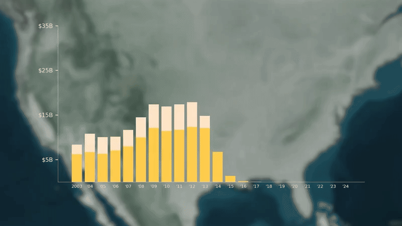
Deportation, Inc.
A multi-part investigation into the emergence of the "Immigration Industrial Complex." A deep-dive into the history, the laws and the data shaping this new reality.
Documentary practitioner whose work combines geospatial analysis with visual storytelling to examine state violence, migration, and human rights.
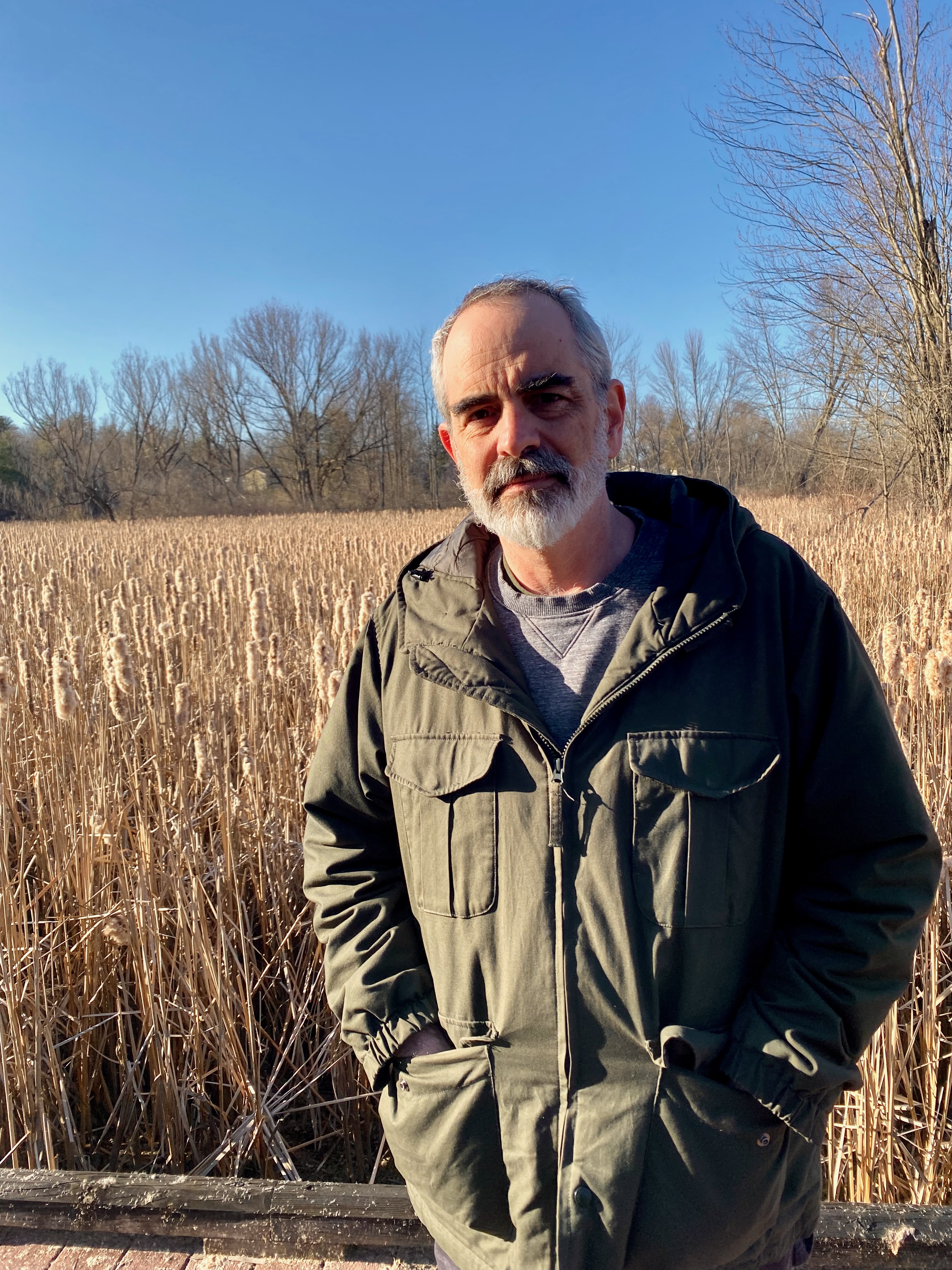
I spent twenty years as a documentary editor, shaping stories for broadcast and independent film. It is a craft I love, but increasingly I wanted my work to do more than reach audiences; I wanted it to matter in courtrooms, in policy debates, and in the lives of people affected by the events I was documenting.
That conviction led me to new partnerships, to investigations that could inform legal accountability, shape policy, and serve communities beyond the screen, and eventually back to graduate school to learn the geospatial technologies now central to investigative journalism. I'm completing my MS in GIS at the University at Albany, developing human-centered approaches to spatial storytelling that make complex evidence accessible while meeting standards for legal accountability.
A multi-part investigation into the emergence of the "Immigration Industrial Complex." A deep-dive into the history, the laws and the data shaping this new reality.
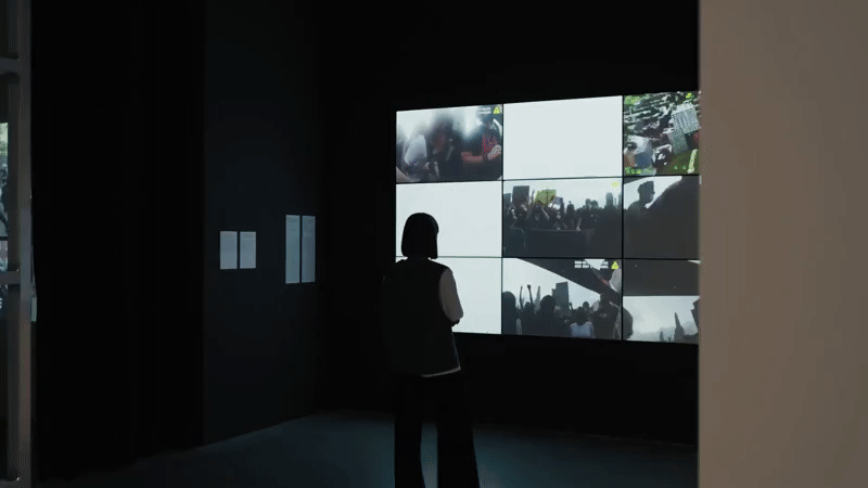
Nine-monitor video installation emerging from class-action legal case against the NYPD. Video work and analysis resulted in successful class-action settlement. Installation appeared at the exhibit: "Visual Investigations" (Architekturmuseum der TUM, Munich) in 2024.
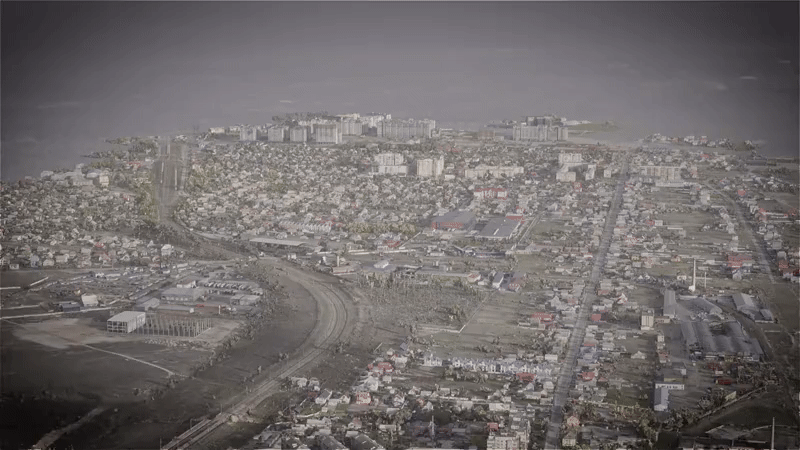
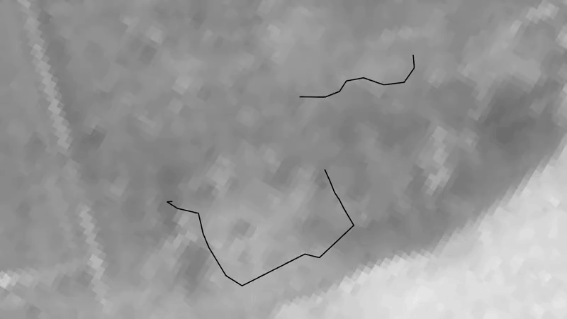
Geospatial investigation documenting Russian war crimes in Bucha, Ukraine, using three-dimensional reconstruction and satellite imagery analysis to establish evidence of systematic killings along Yablunska Street.
A three-part investigative documentary series produced with SITU Research for the United Nations Investigative Team to Promote Accountability for Crimes Committed by Da'esh/ISIL (UNITAD). The series reconstructs three mass atrocity events—the Kocho massacre targeting the Yazidi population, the Tikrit Air Academy massacre, and the Badoush Prison massacre outside Mosul—using satellite imagery analysis, 3D spatial reconstruction, survivor testimony integration, and open-source verification. Created specifically to support international criminal accountability, these investigations translate complex spatial and temporal evidence into courtroom-ready visual documentation while honoring the experiences of survivors and victims.

Investigation documenting the NYPD's deliberate trapping and assault of peaceful protesters in the Bronx on June 4, 2020. Spatial analysis of the police operation revealed systematic coordination rather than spontaneous crowd control, contributing to a subsequent New York Attorney General lawsuit and a record class action settlement for the victims.

The untold story of 1970s video pioneers who went from CBS News to America's first pirate TV station, changing the nature of journalism through portable video.
Introduces and argues for a human-scale approach to spatial storytelling that maintains horizon lines and embodied perspective, challenging traditional overhead mapping through integration of cognitive science research and journalistic practice.
Develops a theoretical framework for understanding 'migrant body commodification'—how state actors convert migrants into extractable political, economic, and diplomatic value through strategic spatial positioning.
An AI-powered analytical instrument that encodes the Migrant Body Commodification framework. Users submit news articles, policy documents, or executive orders, and the tool applies the MBC lens, identifying commodification models, mapping value extraction streams, and drawing comparative connections to established cases.
How election maps became identity politics: examining the technological history and the psychological and democratic costs of journalism's "red state/blue state" framework.
Full-service documentary production with specialized expertise in visual investigations, spatial storytelling, and evidentiary documentation for broadcast and legal contexts.
End-to-end investigative support integrating satellite imagery analysis, open-source verification, and three-dimensional spatial reconstruction for human rights documentation and legal accountability.
Guest lectures, conference presentations, and keynote addresses on geospatial journalism methodology, visual investigations, media history, and the future of spatial storytelling in news media.
Available for documentary production, data analysis, academic collaborations, speaking opportunities, and investigative partnerships.
jnealon@gmail.com